 EN▾











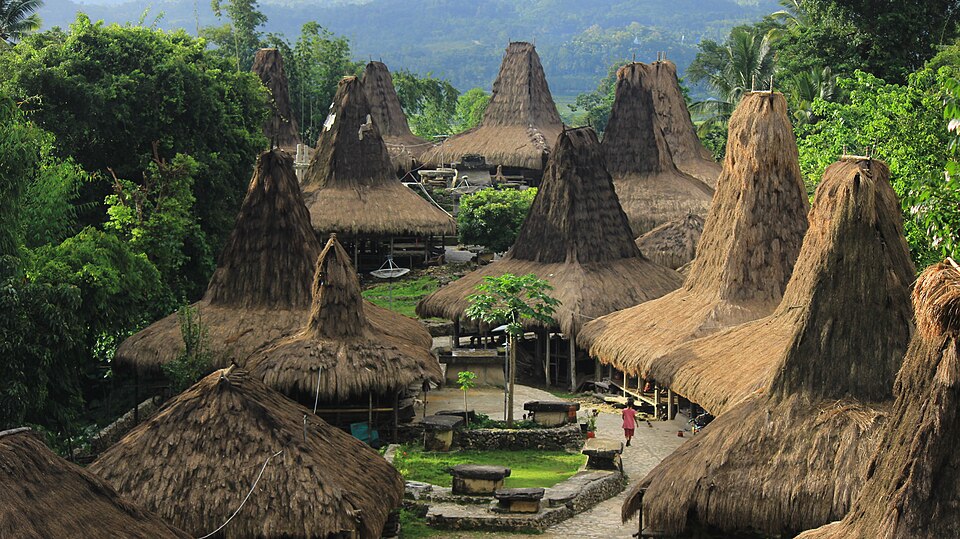
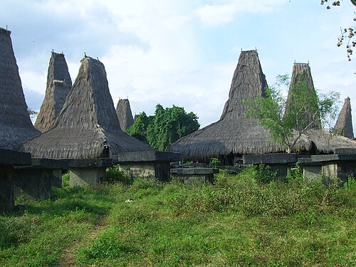
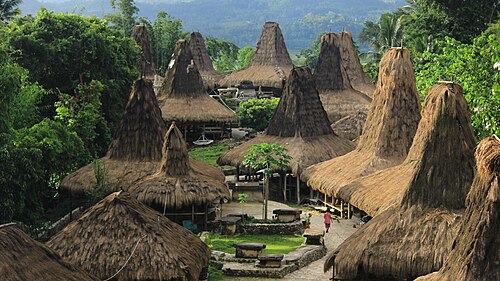
A traditional village in Tebara, on the edge of Waikabubak in West Sumba, with several dozen high-roofed clan houses rising in terraces up a hillside around megalithic tombs. Prai means village and Ijing is a wild fruit tree that once grew here. It is one of the easiest traditional villages to visit from Waikabubak.
🚗 Getting there: distances and drive times
| From | Straight line | By road (approx.) |
|---|---|---|
| Waikabubak | 6 km | ~10 km · 30 min |
| Waibakul | 15 km | ~20 km · 45 min |
| Eco Beach City · Mamboro | 29 km | ~40 km · 1 h 15 min |
| Tambolaka | 33 km | ~45 km · 1 h 30 min |
| Tambolaka Airport (TMC) | 34 km | ~45 km · 1 h 30 min |
| Waingapu | 88 km | ~120 km · 3 h 30 min |
| Waingapu Airport (WGP) | 92 km | ~125 km · 3 h 45 min |
Drive times are estimates for a car with a driver, at about 35 km/h on average including stops and slow village stretches. Allow more time in the rainy season and on the last unpaved section.
🌅 Sunrise and sunset
At Prai Ijing Village the sun rises between 05:31 and 06:20 and sets between 17:47 and 18:31, local time (WITA, UTC+8), depending on the month. So close to the equator, days last about 12 hours all year, and it gets dark quickly after sunset.
✅ Plan your visit
- Traditional villages are homes, not museums: greet people, ask before taking photos and before entering a house.
- Visitors usually sign a guestbook and leave a small contribution; going with a local guide makes the visit easier and more respectful.
- Dress modestly, covering shoulders and knees.
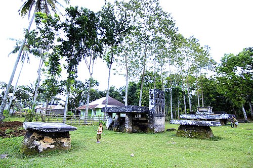
- Do not touch or climb on the stone tombs.
📍 Also within 15 km
- Tarung Village · 5.9 km to the west
- Lapopu Waterfall · 6.5 km to the south-east
- Matayangu Waterfall · 6.9 km to the south-east
- Waigalli Village · 8.8 km to the south
- Pasola field, Wanokaka · 10.3 km to the south
- Gallubakul stone tomb · 11.5 km to the east
- Pasunga Village · 13.3 km to the east
- Weekacura Waterfall · 14.6 km to the west
🌦️ Climate near Prai Ijing Village by month
| Month | Jan | Feb | Mar | Apr | May | Jun | Jul | Aug | Sep | Oct | Nov | Dec |
|---|---|---|---|---|---|---|---|---|---|---|---|---|
| Max °C | 28 | 28 | 28 | 28 | 28 | 28 | 27 | 28 | 29 | 30 | 30 | 28 |
| Min °C | 22 | 22 | 22 | 21 | 20 | 20 | 19 | 19 | 19 | 21 | 22 | 22 |
| Rain mm | 271 | 280 | 289 | 214 | 83 | 57 | 42 | 45 | 85 | 147 | 191 | 261 |
Monthly averages for 2015 to 2024 from Open-Meteo historical weather data (ERA5 reanalysis, a weather model) for the nearest area: Waikabubak. Treat rainfall as approximate: models tend to overestimate it in dry areas.
Questions
Where is Prai Ijing Village?
Prai Ijing Village is in West Sumba, Sumba (East Nusa Tenggara, Indonesia), at -9.6287, 119.4609. The nearest town is Waikabubak, about 6 km away in a straight line.
When is the best time to visit Prai Ijing Village?
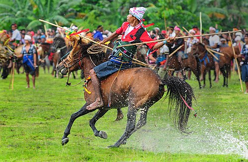
All year round. Go in the morning, and check local calendars: ceremonies and the Pasola (February or March) change the rhythm of the villages.
How do I get to Prai Ijing Village?
The closest airport is Tambolaka Airport (TMC), about 34 km away in a straight line. Most visitors hire a car with a driver; roads off the main routes can be rough.
How far is Prai Ijing Village from Tambolaka Airport (TMC)?
Prai Ijing Village is about 34 km in a straight line from Tambolaka Airport (TMC), roughly 1 h 30 min by road.
How long is the drive from Waikabubak to Prai Ijing Village?
Plan on about 30 min for the roughly 10 km by road from Waikabubak, and more after heavy rain.
Any tips for visiting Prai Ijing Village?
Sign the guestbook and leave a donation. Ask before photographing people, and do not climb on the stone tombs.
Share a photo or tip
Been here? Send us your photo or tip. We review every message before publishing.