 EN▾











Photography and drones in Sumba: best spots, light and the rules
Where and when to take the best photos in Sumba, how to photograph people and villages respectfully, and what to know before flying a drone in Indonesia.
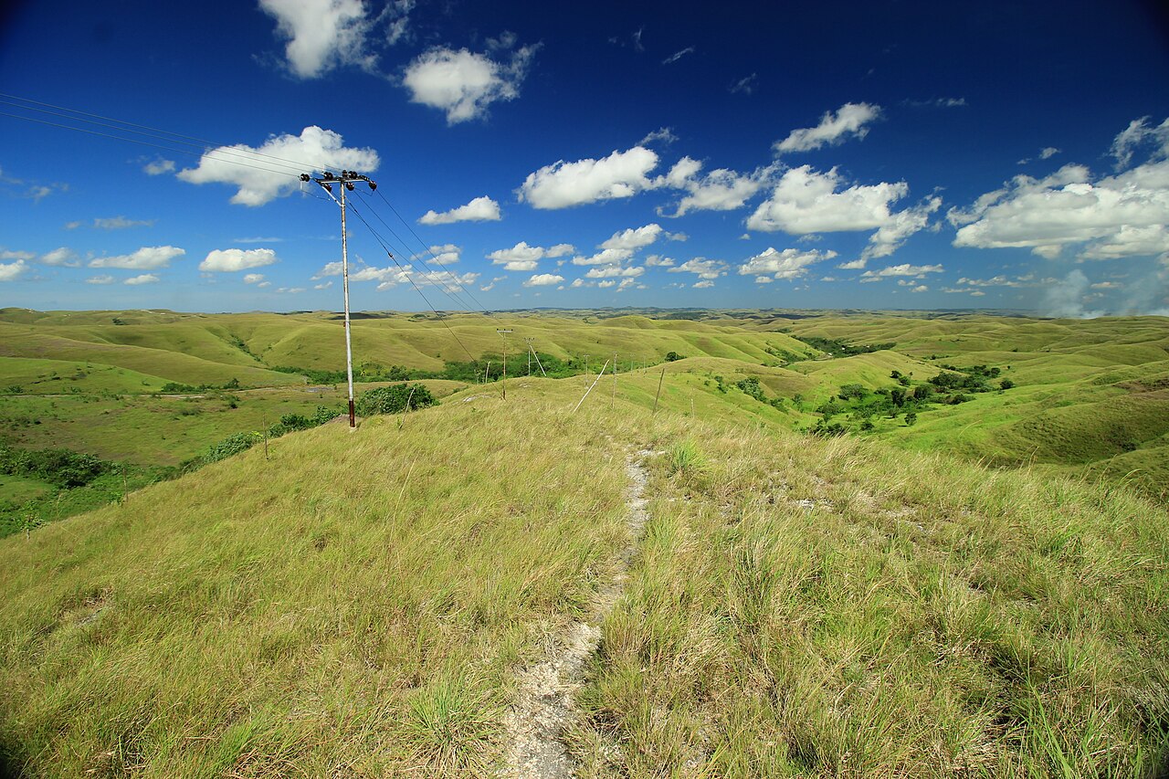

Sumba is one of the most photogenic islands in Indonesia: turquoise lagoons, rolling savanna, towering thatched roofs and some of the best sunsets you will see. A little planning helps you get great pictures while respecting the people and places in front of your lens.
The best light#
Sumba is near the equator, so the sun rises and sets quickly, around 05:30 to 06:20 and 17:45 to 18:30 local time depending on the month. The best light is in the first and last hour. Midday light is harsh, especially in the dry season. Every place page on our site shows the sunrise and sunset range for that spot.
Top photo spots#
- Wairinding Hill: rolling hills at sunrise or late afternoon; green from January to April, golden in the dry season.
- Walakiri Beach: silhouetted mangroves at sunset and low tide.
- Weekuri Lagoon: turquoise water from the viewpoint above.
- Ratenggaro and Prai Ijing: traditional houses and tombs.
- Tanggedu: canyon pools; best with soft light.
- Mandorak: a small cove between cliffs.
More ideas in best sunsets in Sumba.
Photographing people and villages#
- Ask before photographing people, houses and tombs; accept a no gracefully.
- At ceremonies such as the Pasola, follow organisers and your guide.
- Sign the village guestbook and leave a contribution; share photos with people if they ask.
- Read village etiquette.
Drones: what to know#
Indonesia regulates drones under Ministry of Transport regulation PM 37/2020. Travel and customs sources report that drones over 250 g must be registered with the civil aviation authority and that tourists need a temporary flight permit, and that flying near airports and military areas is forbidden. National parks in Indonesia can require separate permits and fees for drone photography. Rules change, so check the latest official information before you travel.
- Keep well away from Tambolaka and Waingapu airports.
- Ask permission before flying over villages, people and ceremonies; never fly over riders and horses at the Pasola.
- Do not fly in Manupeu Tanah Daru or Laiwangi Wanggameti national parks without checking permits; see national parks.
- Fly only in daylight and keep your drone in sight.
Gear tips#
- Bring spare batteries and a power bank: power cuts happen.
- Protect gear from dust in the dry season and humidity in the wet season.
- A polarising filter helps with water and sky.
📍 Places in this guide at a glance
| Place | Region | Type | Nearest airport |
|---|---|---|---|
| Wairinding Hill | East Sumba | ⛰️ Viewpoints | ✈ WGP · 22 km · 1 h |
| Walakiri Beach | East Sumba | 🏖️ Beaches | ✈ WGP · 14 km · 45 min |
| Weekuri Lagoon | Southwest Sumba | 🏖️ Beaches | ✈ TMC · 33 km · 1 h 30 min |
| Ratenggaro Village | Southwest Sumba | 🛖 Villages | ✈ TMC · 36 km · 1 h 30 min |
| Prai Ijing Village | West Sumba | 🛖 Villages | ✈ TMC · 34 km · 1 h 30 min |
| Tanggedu Waterfall | East Sumba | 💧 Waterfalls | ✈ WGP · 25 km · 1 h 15 min |
| Mandorak Beach | Southwest Sumba | 🏖️ Beaches | ✈ TMC · 33 km · 1 h 30 min |
FAQ
Can I fly a drone in Sumba?
Recreational flying is generally possible, but Indonesia regulates drones under PM 37/2020. Sources report that drones over 250 g must be registered and that national parks require permits. Check current rules before you travel.
Where are the best photo spots in Sumba?
Weekuri Lagoon, Wairinding Hill, Walakiri Beach at sunset, the villages of Ratenggaro and Prai Ijing, and the Tanggedu canyon.
Can I photograph people in villages?
Ask first. Many people are happy to be photographed, but always ask permission, especially at ceremonies and around tombs.
Guides
50 best things to do in Sumba
From Weekuri Lagoon to the Pasola, the dancing trees of Walakiri and the megalithic tombs of Anakalang: the best experiences on Sumba island, with a map.
How to get from Bali to Sumba: flights, ferries and airports
Flights from Bali to Tambolaka (TMC) and Waingapu (WGP), which airport to choose, baggage limits, ferries and how to get from the airport to your hotel.
Where to stay in Sumba: the best areas for every trip
Which area of Sumba to stay in: Tambolaka and Kodi, Waikabubak and the south-west coast, Central Sumba and Waingapu in the east, and how to split your nights.
Ferry to Sumba: routes from Flores, Sumbawa, Bali and Timor
How to reach Sumba by boat: Pelni and ASDP routes to Waingapu and Waikelo, typical crossing times, what the ships are like and how to check schedules.
Hiring a driver in Sumba: how it works and what to agree
How to hire a car with driver in Sumba: where to find one, what is usually included, questions to ask, scooter vs car, and tips for a smooth trip.
Sumba on a budget: backpacking tips that really work
How to travel Sumba with little money: where to base yourself, sharing transport, local food and free places worth visiting.