 EN▾











Sumba travel guide: everything you need to plan your trip
The complete guide to Sumba, Indonesia: when to go, how to get there from Bali, the four regions, what to see, costs, safety, etiquette and itineraries.


Sumba is the island people describe when they talk about the Indonesia of thirty years ago: rolling savanna with wild-looking horses, turquoise lagoons, empty beaches facing the Indian Ocean and villages of towering thatched houses where the ancestral Marapu religion is still alive. It is only about an hour's flight from Bali, yet it receives a tiny fraction of Bali's visitors. This guide gathers everything you need to plan a trip, and every place mentioned is on our interactive map.
Sumba at a glance
- Where: East Nusa Tenggara province, south of Flores and east of Sumbawa. Not to be confused with Sumbawa.
- Size: about 11,000 km², roughly twice Bali, with far fewer people.
- Regions: four regencies, Southwest Sumba (capital Tambolaka), West Sumba (Waikabubak), Central Sumba (Waibakul) and East Sumba (Waingapu).
- Airports: Tambolaka (TMC) in the west and Waingapu (WGP) in the east.
- Language: Indonesian everywhere, plus several Sumbanese languages. Little English outside hotels.
- Money: Indonesian rupiah, mostly cash.
- Time zone: Central Indonesia Time (WITA, UTC+8), the same as Bali.
Why visit Sumba
Three things make Sumba different from almost anywhere else in Indonesia. First, its living culture: Marapu, the belief in ancestral spirits, still shapes daily life, from the shape of the houses to the huge stone tombs in front of them and the Pasola, a ritual contest on horseback. Second, its landscapes: the east is dry savanna and limestone hills, the west is greener, with rice terraces, forests and waterfalls. Third, its emptiness: on many beaches you will be the only visitor, and the surf breaks of the south coast are among the most consistent in the country.
The flip side is that Sumba is not easy. Roads are slow, distances are long, there is little public transport, few restaurants and limited healthcare. If you want nightlife, cafés and short transfers, Bali is the better choice; see our honest Sumba or Bali comparison.
The four regions and what to see in each
Southwest Sumba (Kodi and Tambolaka)
Most first-time visitors start here because Tambolaka airport has the most flights. The Kodi coast has the island's most photographed sights: Weekuri Lagoon, a saltwater lagoon behind a coral wall; the cliffs of Mandorak Beach; the sunsets of Pero Beach; and the traditional villages of Ratenggaro and Wainyapu, with some of the tallest roofs on the island. Inland, Weekacura spills over terraces in the middle of rice fields.
West Sumba (Waikabubak, Lamboya and Wanokaka)
Cooler and greener, with Waikabubak as its hill-town capital. Traditional villages such as Tarung sit right inside the town. To the south are the beaches of Marosi and Rua, the Pasola field of Wanokaka and Lapopu, the island's best-known waterfall, inside Matalawa National Park.
Central Sumba (Anakalang, Waibakul and Mamboro)
The least visited region and one of the most rewarding. Around Anakalang are some of Sumba's finest megalithic tombs, at Pasunga and Gallubakul. In the forest of the national park hides Matayangu waterfall. On the north coast, the savanna and beaches around Mamboro are almost untouched; see our top 10 around Mamboro.
East Sumba (Waingapu and the savanna)
The east is drier and more open. Waingapu, the island's largest town, is the base for the hills of Wairinding, the canyon pools of Tanggedu, the mangrove "dancing trees" of Walakiri Beach at sunset, the savanna and beach of Puru Kambera and the ikat-weaving villages of Prailiu and Rende. Further south are Waimarang and the surf bay of Tarimbang.
When to go
Sumba has a dry season from roughly May to October and a wet season from about November or December to March or April. The east is markedly drier than the west. In the dry season the savanna turns golden, roads are easier and waterfalls are clear, though some become thin by September and October. In the wet season the hills are spectacularly green but unpaved roads can become impassable and waterfalls turn brown after heavy rain. The Pasola takes place in February and March. Full details in our guide to the weather.
How to get to Sumba
Almost everyone flies. There are daily flights from Bali (Denpasar) to Tambolaka and regular flights to Waingapu, plus connections from Kupang and other Indonesian cities. The flight from Bali takes around an hour on small turboprop planes with tight baggage limits. The smartest plan is to fly into one airport and out of the other so you never have to drive back across the island. Slow ferries also link Sumba with Sumbawa, Flores and Timor. Everything is explained in how to get from Bali to Sumba.
Getting around
There are no trains, almost no taxis outside the towns and only basic public minibuses. Most visitors hire a car with a local driver, which also solves navigation and language. Confident riders rent scooters in the towns, but distances are long and roads can be rough. Allow plenty of time: a 100 km drive can take three hours. See getting around Sumba.
How many days and suggested routes
- 3 days: the west only. Our 3-day route.
- 5 days: west and east, flying in and out of different airports. Our 5-day route.
- 7 days or more: the whole island, including the south and north coasts. Our 7-day route.
Where to stay
Accommodation clusters around the airports and towns: Tambolaka and the Kodi coast in the south-west, Waikabubak and the Lamboya and Wanokaka coast in the west, and Waingapu in the east. Options range from simple guesthouses to some of the most famous luxury resorts in Asia, with little in between in some areas. Read where to stay in Sumba before booking.
Money and costs
Bring enough cash. There are ATMs in the main towns (Tambolaka, Waikabubak, Waibakul and Waingapu) but none along the coasts, and card payments are rare outside hotels. The biggest costs are flights, accommodation and the car with driver; entrance fees and village donations are small but frequent. See how much a trip costs.
Visiting traditional villages
Villages are homes, not museums. At the entrance you will usually sign a guestbook and leave a donation. Ask before taking photos of people, never climb on the stone tombs and dress modestly. Children may ask for money or sweets; buying ikat or other crafts directly from the makers is a better way to help. Our etiquette guide and guide to the traditional villages explain how to visit well.
Health and safety
Sumba is generally peaceful, but it is remote. Medical facilities are basic, and serious cases are evacuated by air, so get insurance that covers evacuation. Use mosquito repellent, carry water, and be careful in the sea: the south coast faces the open ocean with strong currents and reef breaks. The biggest everyday risk is the road, especially at night. More in health and safety in Sumba.
Practical tips
- Download offline maps before you go; mobile signal disappears in many areas.
- Carry small notes for entrance fees, parking and donations.
- Pack reef-safe sun protection, a hat, sandals with grip and a light layer for the hills.
- Learn a few words of Indonesian: terima kasih (thank you), permisi (excuse me), berapa? (how much?).
- Respect the drone rules of villages and sacred sites: always ask first.
Everything else is in our practical tips for Sumba.
Is Sumba worth it?
If you are looking for culture that is lived rather than performed, wild landscapes and the feeling of travelling somewhere still unknown, very much so. Plan realistically, go slowly and treat the island with respect, and Sumba will be one of the most memorable trips you take in Indonesia. Start with the interactive map and our list of secret spots.
FAQ
Where is Sumba?
Sumba is an island in East Nusa Tenggara, eastern Indonesia, south of Flores and about an hour's flight east of Bali. It is roughly twice the size of Bali.
How many days do you need in Sumba?
Three days is enough for the west, five days lets you see the west and the east if you fly into one airport and out of the other, and a week or more lets you reach the remote south and north coasts.
What is the best time to visit Sumba?
The dry season, roughly May to October, has the easiest roads and the most reliable weather. February and March are the months of the Pasola, and the hills are greenest from January to April.
Is Sumba safe for tourists?
Sumba is generally calm and welcoming. The main risks are long drives on narrow roads, strong currents on the south coast and limited medical care, so travel insurance with evacuation cover is essential.
Do I need a guide in Sumba?
Not by law, but a local driver-guide makes the trip much easier: public transport is very limited, signposting is poor and a guide can introduce you properly in traditional villages.
Is Sumba the same as Sumbawa?
No. Sumbawa is a different island to the north-west, between Lombok and Flores. Sumba lies further south.
Guides
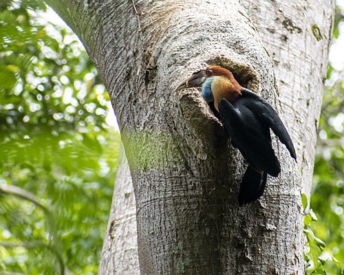
Hiring a driver in Sumba: how it works and what to agree
How to hire a car with driver in Sumba: where to find one, what is usually included, questions to ask, scooter vs car, and tips for a smooth trip.
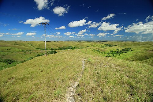
25 best things to do in Sumba
From Weekuri Lagoon to the Pasola, the dancing trees of Walakiri and the megalithic tombs of Anakalang: the best experiences on Sumba island, with a map.
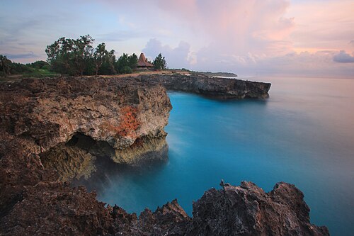
The best beaches in Sumba (with map)
Every beach worth the drive on Sumba: lagoons, surf breaks, sunset spots and empty white sand on all four coasts, with tips on safety and access.
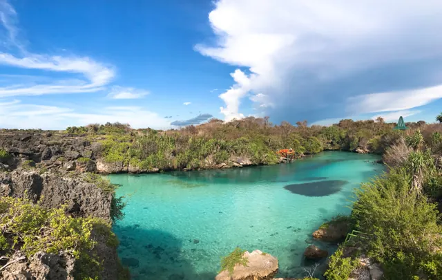
How to get from Bali to Sumba: flights, ferries and airports
Flights from Bali to Tambolaka (TMC) and Waingapu (WGP), which airport to choose, baggage limits, ferries and how to get from the airport to your hotel.
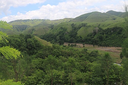
Getting around Sumba: drivers, scooters, roads and maps
How to travel around Sumba: hiring a car with driver, renting a scooter, road conditions, fuel, mobile signal and offline maps.
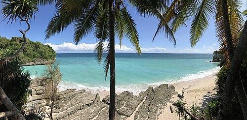
Where to stay in Sumba: the best areas for every trip
Which area of Sumba to stay in: Tambolaka and Kodi, Waikabubak and the south-west coast, Central Sumba and Waingapu in the east, and how to split your nights.